Where they guessed
Choose a location and model. The diamond marks the real location.
Each guess, beside what the model saw
Choose a location to see the model guesses. Click a model to show its saved images on the right.
Drag to pan. Use + / − or Ctrl + scroll to zoom. ◇ marks the true starting location.
Model’s explanation
Could not load this saved image. Try reloading the page.
Click the image to open it at full size. Exploration images differ between models; the answer stays at the original starting location.
World outline: Natural Earth, public domain. Images are the original saved model inputs.
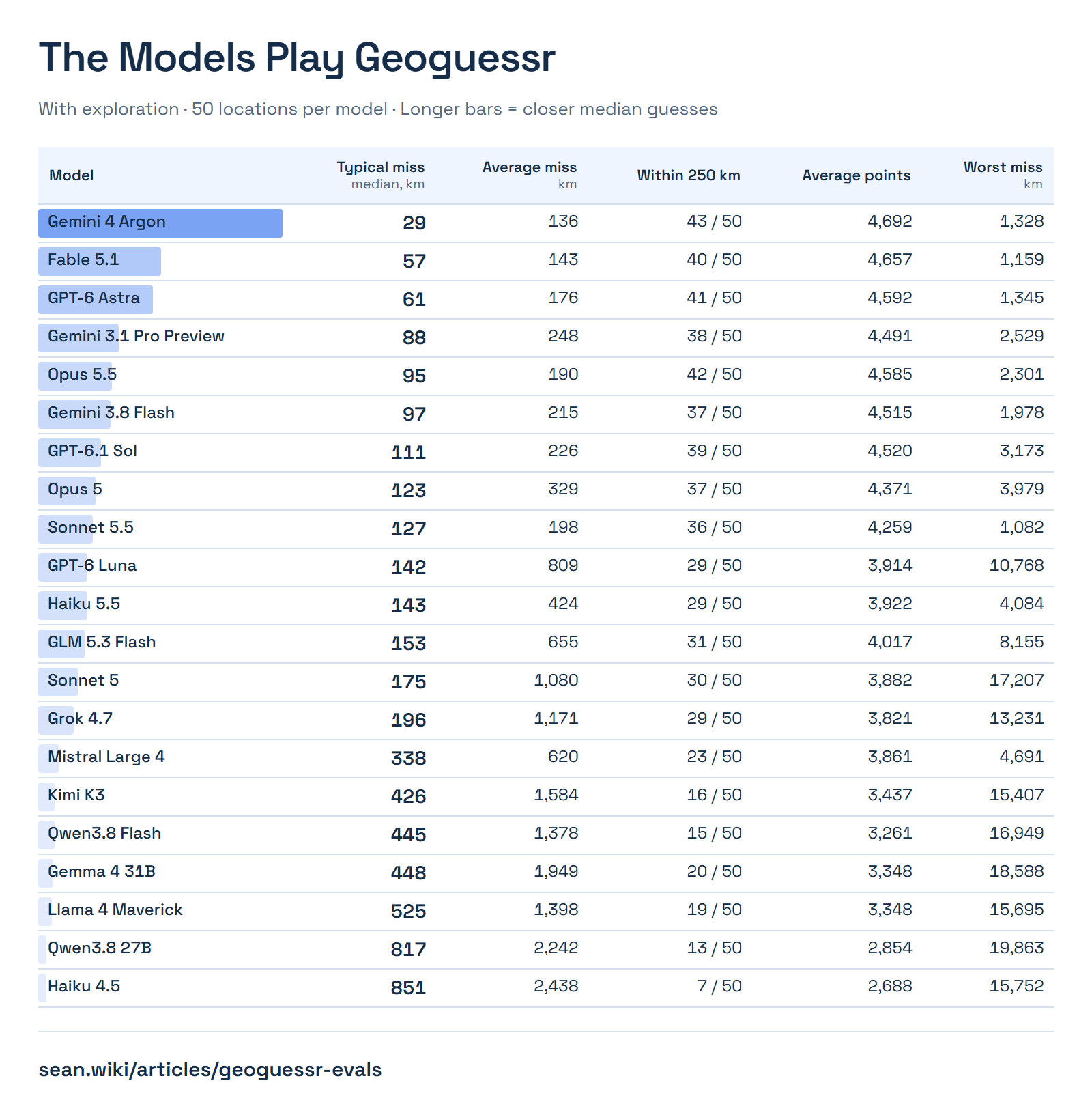
How far they missed
| Model | Valid guesses | Typical miss median, km | Average miss km | Within 250 km | Average points | Worst miss km |
|---|
Closest to farthest
One dot per guess. Each model is sorted independently. Select a dot to inspect it.
Select a dot to see its location and saved explanation.
Did looking around help?
One-image median Exploration-allowed median. Smaller is closer.
Which locations got another look?
One square per location. Color means at least one exploration action.
Setup and model settings
The same 50 locations, without exploration or with up to eight actions. Models choose actions and coordinates; the harness drives the website. Screenshots hide the guess map and score hints.
| Version | Requested ID | Effort | Answer format |
|---|